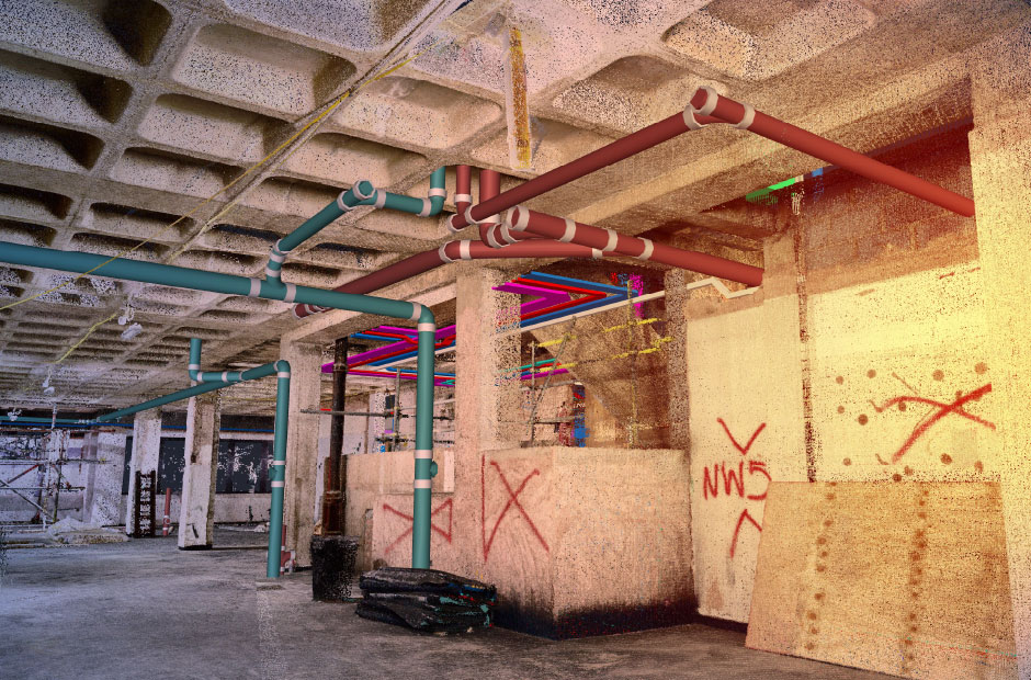
We offer laser scans as one of our surveying services as they are a quick and efficient way to collect extremely accurate data about on-site conditions. This article will explore what laser scanning entails, how point clouds can be used to deliver 3D models, and some of the advantages associated with the “scan to BIM process”.
What is laser scanning?
Laser scanning is a popular surveying method that accurately collects and measures data from buildings, landscapes, objects and surfaces using a line of laser light to form ‘point clouds’ of data.
Laser scanning originated as part of airborne submarine detection but its use for airborne and ground-based surveying in architecture and construction is becoming more and more popular.
How does laser scanning work?
Laser scanning systems throw out light waves that bounce off surfaces and reflect back to the sensor. The sensor can then calculate how far away this surface is by measuring the time taken for the beam of light to complete its journey, also known as the ‘time of flight’ measurement.
The distance measured is then used to calculate a coordinate for the tiny section of the surface that has been hit by the laser beam. As the light can only travel in a straight line, surveyors will need to complete a number of scans from a variety of locations to ensure complete coverage of the site. They can also increase the resolution of the scan by merging photos with the scan data or reference geo-coordinate systems.
Laser scanners can capture enormous amounts of data every second, and so before the surveyor begins, they need to think about what the data they are going to collect will be used for. This will give them an appropriate scan area, scan targets and the required resolution they need.
What type of laser scanners are most commonly used?
There are lots of different types of scanners available, but they all tend to work on the same principle.
Close range laser scanners that cover small objects observed from less than half a metre away are available, right up to scanners that work at ranges between 20m to 2km – although accuracy varies from a few mm to 100mm.
Airborne scans from a helicopter are also possible, although the higher the vantage point, the less accurate they will be.
How do we use and manipulate data from a laser scanning process?
Data is extracted from the scanner unit by connecting the device to a PC, and then calibrating the raw scan data using analysis and modelling techniques. We then import the data into our BIM authoring tool in order to be able to manipulate them.
What are the benefits associated with laser scanning?
Laser scans can be used to communicate information on existing conditions to contractors, designers and project managers in the early stages of a BIM project, meaning better decisions can be made throughout.
Laser scanning can also offer major time-saving benefits to construction projects as they allow significantly higher volumes of data to be collected and shared in a shorter amount of time, meaning the team can get on with design work, project scoping or verifying progress on site.
Other benefits associated with laser scanning include more accurate and complete delivery, better off-site fabrication and fewer modifications needed on site. Scans can also reduce the need for site revisits, which result in cheaper and quicker project turnarounds.
If your business is involved in construction or similar activity, then why not consider using The CAD Room to help you develop high-quality 3D BIM models from your point cloud data. To find out more, please get in touch.

