Welcome to The CAD Room, your gateway to precise and comprehensive topographical surveys that redefine accuracy and efficiency in project planning and development. In this blog, we delve deep into the realm of topographical surveys, unravelling their significance, scope, and invaluable role in shaping various projects.
Understanding Topographical Surveys
Topographical surveys are the cornerstone of meticulous planning and execution within any developmental project. They serve as a definitive and intricate map of existing surface features, meticulously capturing and documenting many landscape elements. These encompass various vital components such as buildings, trees, walkways, utility poles, service covers, retaining walls, and an extensive list of other significant features.
At The CAD Room, our specialised expertise extends beyond mere mapping; we are dedicated to capturing complex and varied details with unparalleled precision. Our team is adept at utilising cutting-edge technology and leveraging extensive experience to ensure that every minute aspect of the surveyed area is comprehensively and accurately documented. This commitment to precision forms the bedrock of our topographical survey services, delivering invaluable insights crucial for informed decision-making in project planning and execution.
The Core Components
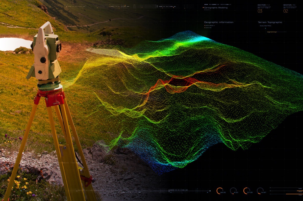
The crux of topographical surveys lies in their ability to meticulously model ground contours, an essential and foundational component that shapes the landscape of numerous applications. This crucial facet serves as the backbone of multifaceted operations within diverse industries. Beyond the simple depiction of surface features, the intricate modelling of ground contours holds paramount importance in various realms. It acts as the keystone for developmental projects, facilitating precise volume calculations, aiding in the intricate designs of highways, enabling accurate stockpile surveys, and even playing a pivotal role in the seamless facilitation of planning applications.
At The CAD Room, our commitment to capturing these ground contours with exceptional accuracy and detail allows us to provide invaluable data that fuels informed decision-making and fosters the success of various projects across different sectors.
Who Conducts Topographical Surveys?
At The CAD Room, our seasoned professionals, equipped with cutting-edge technology and extensive experience, spearhead topographical surveys. Their expertise ensures that every detail, no matter how minute, is accurately mapped, providing a comprehensive overview of the surveyed area.
Do You Need a Topographic Survey for Planning Permission?
Topographical surveys are the cornerstone of meticulous planning and execution within any developmental project. They serve as a definitive and intricate map of existing surface features, meticulously capturing and documenting many landscape elements. These encompass various vital components such as buildings, trees, walkways, utility poles, service covers, retaining walls, and an extensive list of other significant features.
At The CAD Room, our specialised expertise extends beyond mere mapping; we are dedicated to capturing complex and varied details with unparalleled precision. Our team is adept at utilising cutting-edge technology and leveraging extensive experience to ensure that every minute aspect of the surveyed area is comprehensively and accurately documented. This commitment to precision forms the bedrock of our topographical survey services, delivering invaluable insights crucial for informed decision-making in project planning and execution.
Conclusion
Topographical surveys are more than just maps; they are blueprints for success in any development venture. At The CAD Room, we pride ourselves on delivering comprehensive and precise surveys that form the bedrock of successful projects.
For precise, detailed, and invaluable topographical surveys that redefine accuracy, trust The CAD Room.
Contact us today to learn how our topographical surveys can transform your project planning.