A point cloud can be defined as “a collection of data points in space produced by 3D scanners.” Laser scanners capture an accurate as-built scan of an area, which we then use to draw the existing structure with the exact dimensions and specifications. The information captured in this scan is then turned into a precise as-built BIM model.
What are point cloud (PCL) surveys?
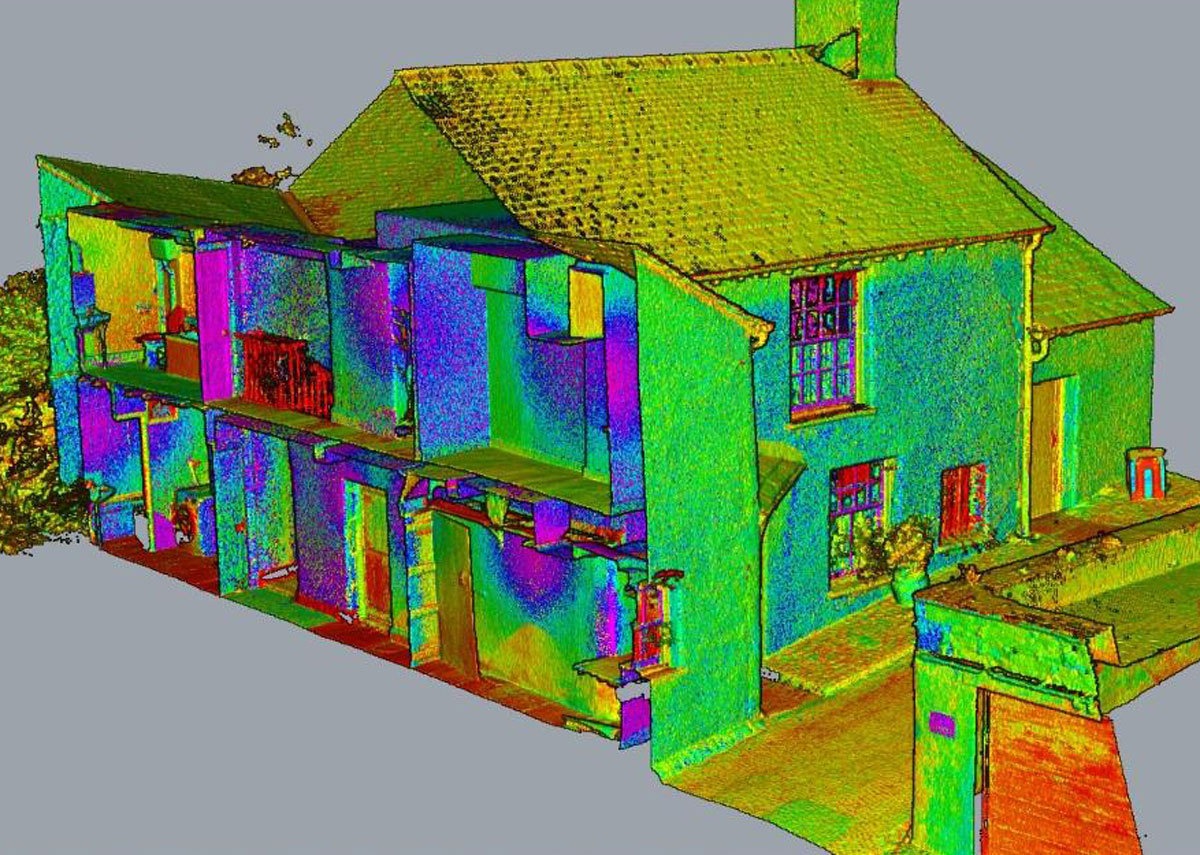
Our point cloud surveys use a Leica P-Series scanner with powerful Leica Cyclone software. We measure many points on the surface of a physical object – such as an existing building or landscape and associate each of these points with a coordinate, meaning we can quickly locate them within the scan. These points are also then collected into a cloud – the point cloud.
Using this technology means we can either use the point clouds in-house to produce BIM models to suit any specification and budget or to provide our clients with cleaned or uncleaned fully registered point clouds and registration reports in formats .PTS to .E57.
The benefits of point cloud surveys for BIM
There are many benefits associated with using point cloud surveys for BIM, including:
- Better accuracy – Point Clouds allow us to match our 3D model with the real world more accurately, better representing difficult and limited locations.
- Better collaboration – Using point clouds as the basis for our 3D model means that all construction team members – architects, builders and designers – have access to the precise measurements of the site and can therefore plan the project accordingly.
- Enhanced project management – Similar to the better collaboration benefit, point clouds offer the most precise method for building realistic interactive 3D models of the physical site for the whole project team.
Integrating point cloud surveys into BIM workflows
Once the actual laser scan of the site has been completed, the next step is to incorporate the information into the BIM workflow using the following three steps:
- Verification – This stage starts with a Scope of Work (SOW) which defines trades to be included or excluded, the level of detail required by the client, and other necessary information.
- Insertion – This is the stage where the point cloud scan is inserted into the BIM software, ensuring the coordinates and integrity of the files are assured.
- File Set-Up – The next stage involves setting up worksets according to the need of the project.
- Modelling – There are a few guidelines in the BIM execution plan that need to be followed in this stage to ensure the real data can be updated at any point in the project.
Our expertise as a BIM company lies in coordinating the MEP services within the building for many industry sectors, including healthcare and education. We often use point clouds to coordinate MEP services within a structure and ensure clash detection. Our surveying department can complete the full Survey to BIM process in-house, using 3D laser scanning alongside the latest technologies.
If you want to explore the potential of point cloud surveys in your BIM workflow, please get in touch at 0161 427 0348 or at office@thecadroom.com