The CAD Room is a BIM outsourcing company offering BIM-compliant services to the construction industry. Data is vital to any construction project, so having access to accurate data is crucial to success. We use topographical surveys to help us get access to detailed level information about the contours of the ground and any existing features in the area of the projects we are working on.
Understanding Topographical Surveys
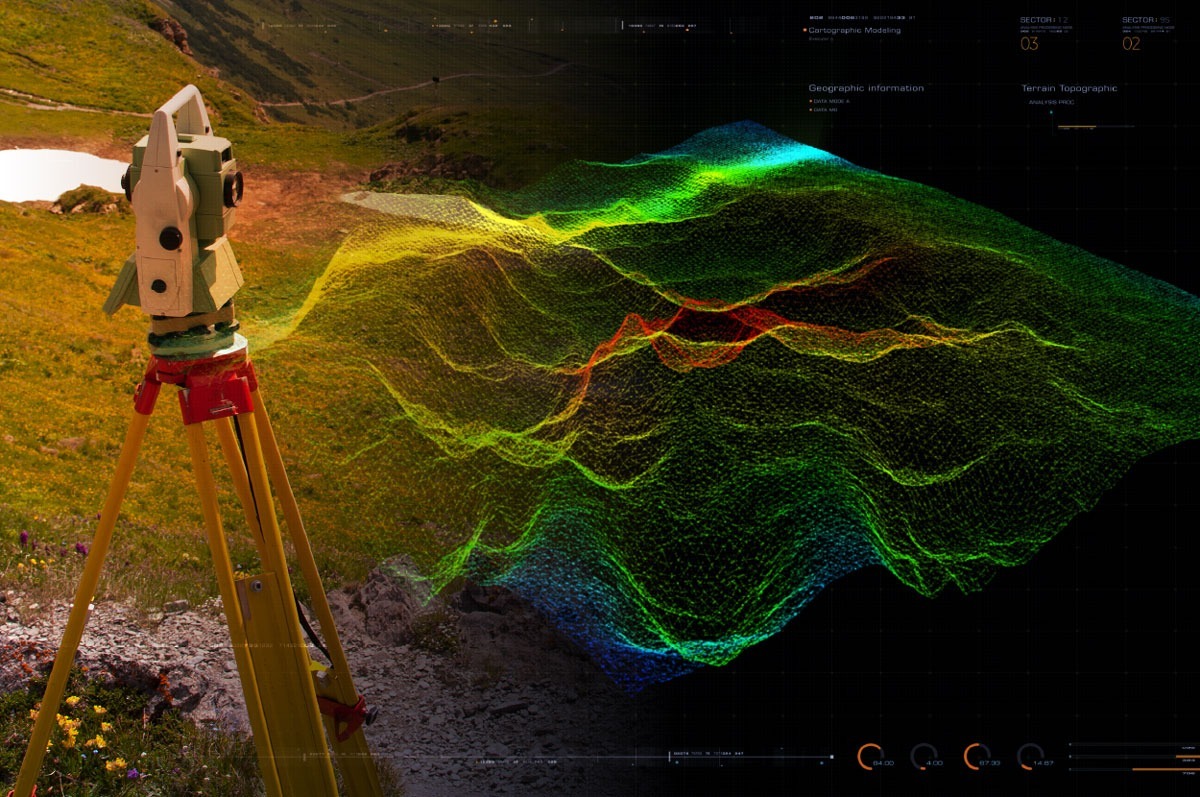
Topographical surveys are used to measure up features on the ground and then plot these measured features to produce a plan of the area. They are usually undertaken by a land surveyor, using specialist measuring equipment to enable the surveyor to calculate the location of a feature precisely. They are used to determine if a development can be safely undertaken, as they can show whether the development will fit within the site and more complex issues, such as whether a local river may cause the area to flood.
Benefits of Topographical Surveys in The CAD Room Projects
Topographical surveys can provide precise elevation information as they identify land contours and spot levels. They also help us identify natural features and obstacles such as buildings, fences, trees and streams. Topographical surveys are helpful for site analysis and planning in The CAD Room projects to help us visualise the client’s site and help bring forward development.
Integrating Topographical Survey Data into Building Design
The BIM software simplifies topographic survey mapping to help us generate a more accurate existing-site conditions model that we can integrate with our intelligent, 3D model-based design workflows to enhance efficiencies and design quality.
The data we capture in topographic surveys offers us many benefits, including:
- Unified control points on models and site elements, improving field layout processes
- A reduction in overall project timelines, thanks to streamlined job site surveys
- Easy sharing of data with other vendors or decision-makers to improve workflow
Best Practices for Using Topographical Surveys in BIM Projects
As a BIM service supplier, we have used various surveying services as part of our projects over the years – which is why we are delighted to have this in-house knowledge and skill now. We can provide architects, local authorities and structural engineers with tailor-made packages to suit your needs.
We use the latest equipment and technology, such as Cyclone, HDS scanners, Leica instruments and N4ce, to provide surveying services, including topographical surveys, measured surveys and 3D solid surveys, PCL and survey to BIM. We work hard to ensure we can cover large areas accurately and efficiently and then pass this efficiency on to you.
Topographical surveys are vital to any construction project as they provide a wealth of information regarding the property for planning purposes. Integrating accurate survey data into our BIM plans means you can rest assured that your plans are precise, inspiring confidence and saving you money and time.
If you want to leverage our topographical survey service to improve your construction project outcomes, please get in touch on 0161 427 0348 or at office@thecadroom.com