As your professional BIM outsourcing partner, The CAD Room are always on the lookout for services that we can offer you that will enable us to deliver you better results. This is where our surveying services come in.
In the past, architects used manual surveying techniques to help create a two-dimensional (2D) set of elevations and plans. However, buildings nowadays require much greater attention to detail than these techniques can deliver. We now use the latest equipment and HDR scanning technology, such as HDS scanners and Leica instruments.
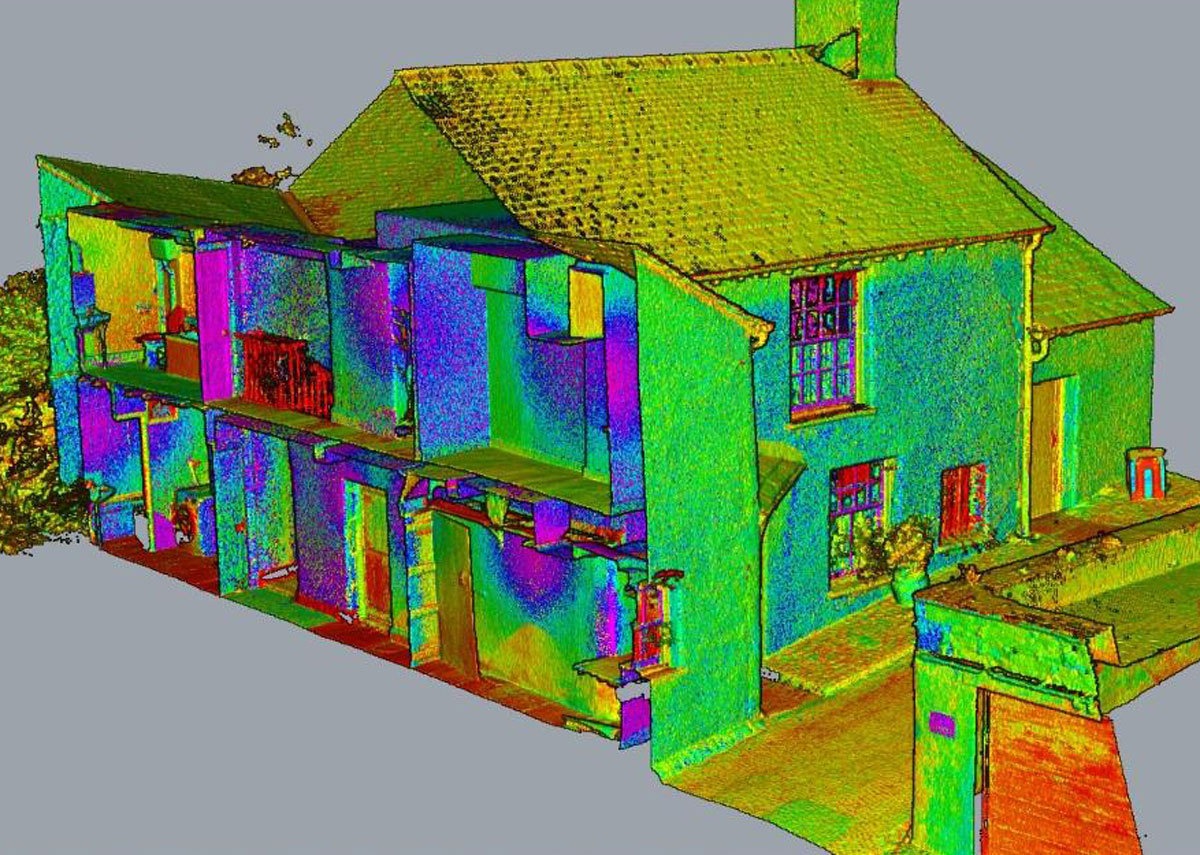
Laser scans are the easiest way to collect accurate data about on-site conditions, as they allow us to provide our clients with fully registered (cleaned or uncleaned) point clouds. But what are point clouds, and how do point cloud surveys work?
What is a point cloud?
TechTarget defines a point cloud as a “collection of data points defined by a given coordinate system.” So, “in a 3D coordinate system, for example, a point cloud may define the shape of some real or created physical system.”
A 3D scanner is used to measure a large number of points on the surface of a physical object – such as a landscape or an existing building. These points have a coordinate associated with them – such as X, Y and Z – meaning each point is easily locatable within the scan. These points are all then collected into a cloud – the point cloud.
What are point cloud surveys used for?
Point cloud surveys (PCL) are usually used on projects that involve:
- Modelling of existing buildings before the renovation starts
- Modelling of the existing surroundings before a new building is constructed
- Modelling an “as-built” structure to be able to detect any deviations from the original plan
We have found that point clouds are prevalent in the as-built stage of a project, as the associated laser scans accurately record any existing installation, which we can then correctly model and record for future maintenance. Many of our clients have found this to save them an incredible amount of budget and time. It removes the need to manually mark up their drawings to indicate changes on-site and frees up their site engineers to concentrate on other, more critical tasks.
How do point cloud surveys fit in with other surveys we offer?
If you are interested in using our surveying services to enrich your construction project, please get in touch to discuss your requirements so that we can determine what services you might need.
These services include:
- Land and Building Surveys, such as topographical surveys or measured building surveys
- BIM Models, such as point clouds or 2D to 3D conversion
We will then arrange a survey date and time that suits you, and on that day, our experienced surveyor will arrive and carry out the necessary surveying work.
As a leading BIM service provider, we offer a complete BIM service for the building services industry – from a simple sketch to an entire drawing project. Whether you are an architect, structural engineer or a local authority, we’d love to partner with you and offer you surveying services to suit your budget and time frame. Get in touch to find out more.